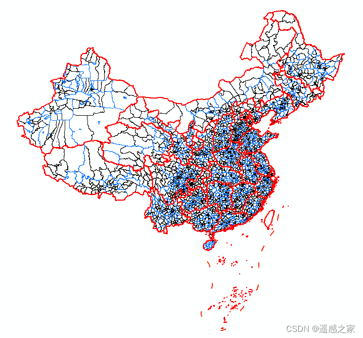
 Province/City/County Administrative Division Data, Early 2020
# Data Access
https://www.shengshixian.com/pages/d35ae5
# Background
Administrative-division data is an important category of foundational geographic information; however, the administrative-division datasets currently available on the market all have notable issues. Below is a list of several commonly used administrative-division datasets for reference:
| Name | Time | Advantages | Disadvantages | Source |
|---|---|---|---|---|
| National Fundamental Geographic Information Administrative Division Data | 2019 | Authoritative | Lacks attributes and time series | ngcc.cn |
| ResDC (CAS Resources and Environment) Administrative Division Data | 2015 | Authoritative and accurate | Data is outdated; many vector errors | resdc.cn |
| Tianditu (National Platform for Common Geospatial Information Services) scraped vector data | Not counted | Authoritative and accurate | Can only be downloaded by province | tianditu.gov.cn |
| Ministry of Civil Affairs (MCA) administrative-division data | 2018 | Authoritative and accurate | Not publicly downloadable; only line vectors | dmfw.mca.gov.cn |
| gadm data | 2022 | Easy to download | Incomplete map; not authoritative | gadm.org |
| AutoNavi (Amap) administrative-division data | 2022 | Timely | Not authoritative; lacks attributes; inconvenient to download | datav.aliyun.com |
| Compilation by an enthusiast (Shudu Chengshi) | 2018–2022 | Attributes are complete | Not authoritative; not publicly downloadable | Public account: Shudu Chengshi (数读城事) |
| University of California, Berkeley administrative-division data | 1949–2013 | Long time series | Not authoritative or accurate |
Based on the issues above, I would like to build, on top of authoritative administrative-division data, a long time-series dataset with attributes conforming to the Ministry of Civil Affairs (MCA) that is openly accessible. The most authoritative administrative-division dataset currently available is the National Fundamental Geographic Information Data released by the National Geomatics Center of China in January 2022, with a currency of 2019; however, this dataset also has many issues.
Therefore, based on the 1:1,000,000 administrative-division data, the MCA place-name data, and other vector data, I have produced the early-2020 administrative-division dataset. In the coming period, I will successively update the administrative-division data from 2015 to 2022 based on this 2020 dataset together with MCA's historical administrative-division materials.
# Data-Processing Principles
(1) Modify the vector data as little as possible;
(2) The vectors for the national boundary and the South China Sea islands must never be modified; they follow the National Fundamental Geographic Information data released in 2022 without exception;
(3) All local attributes and jurisdiction information follow the MCA 2019 data without exception.
# Production Workflow
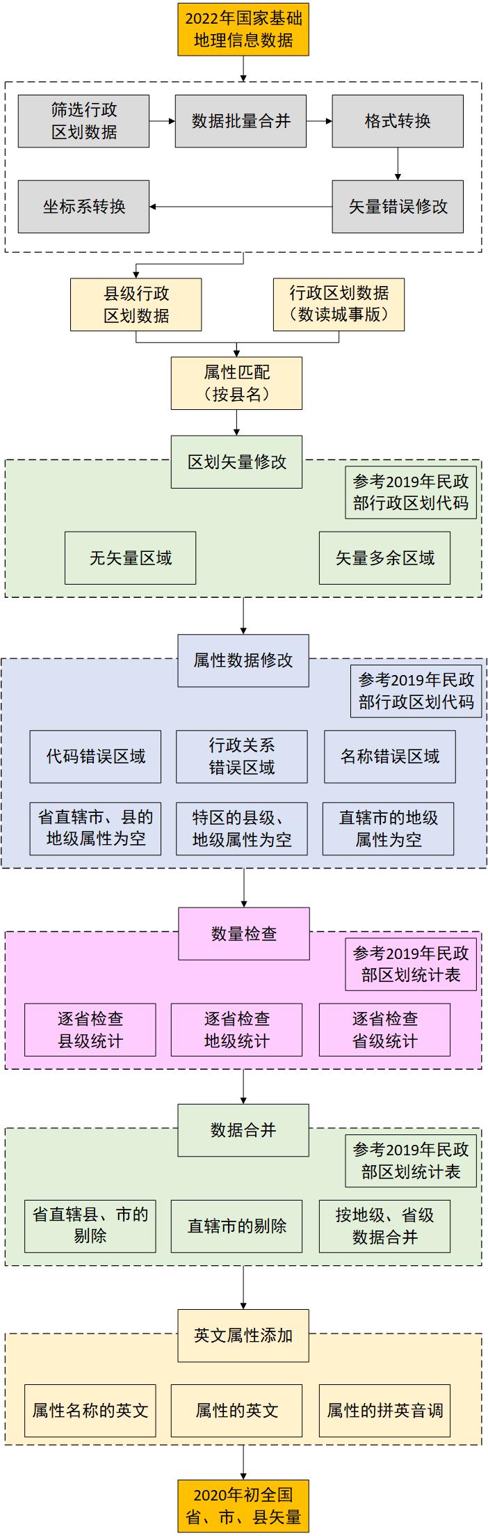
# Processing of the National Fundamental Geographic Information Data
I previously wrote a blog post describing how to process this database; for details see: 1:100w Foundation Geographic Information Data Mosaicking (zhuanlan.zhihu.com/p/458211981)
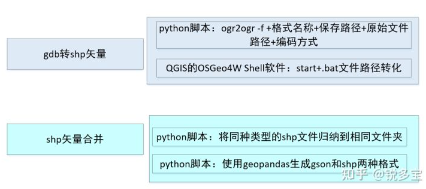
After the steps above are completed, the data is in tiles.
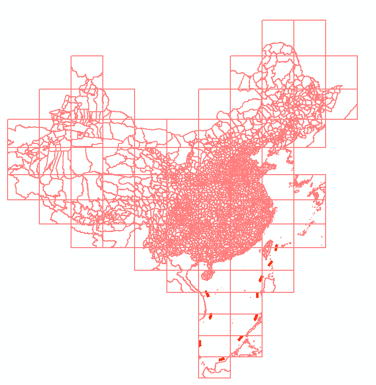
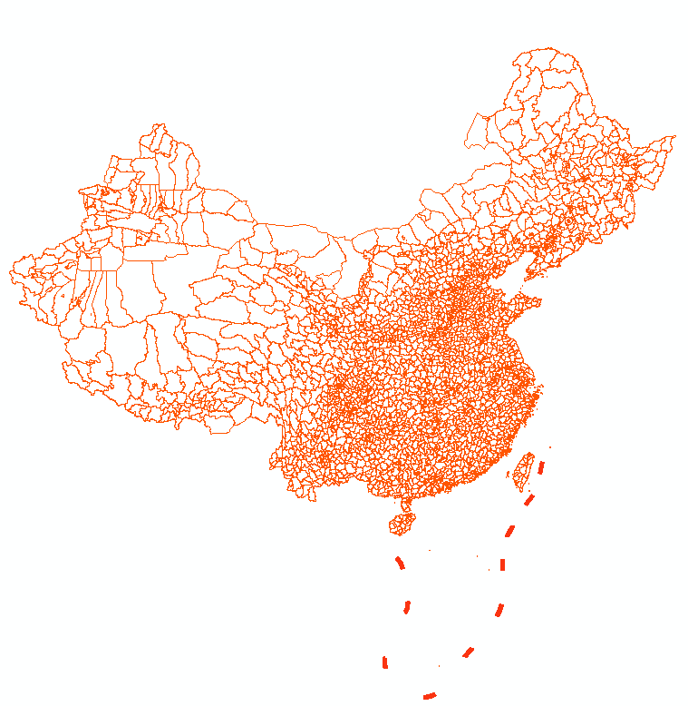
Dissolve the data by county name to eliminate the block-like combinations below, then finally select the China extent. The administrative-division data obtained is shown below.
# Attribute Matching
At this point, I would first like to thank the public account Shudu Chengshi (数读城事) for its years of administrative-division data updates. This dataset's attribute information is the most complete and aligns with the MCA codes. I used this dataset directly to perform a spatial join based on county name. As a result, our administrative-division data is initially endowed with attribute information for each county.
# Administrative-Division Vector Modification
# Data Repair
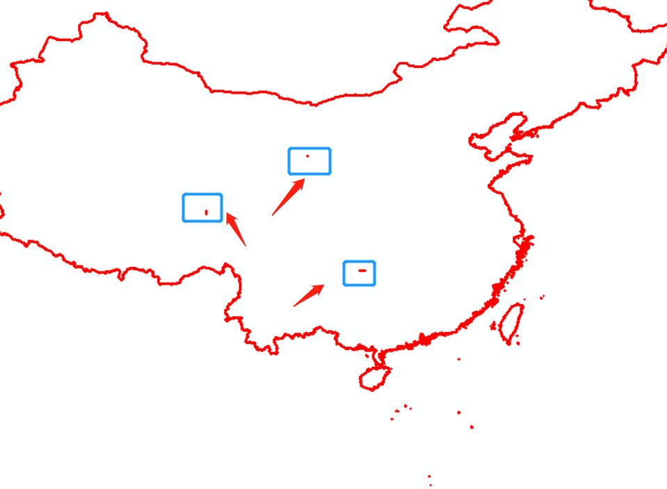
Since this dataset contains numerous vector topology errors, we first use the Repair Geometry function built into ArcGIS to fix them. For locations that cannot be repaired automatically, we perform spatial snapping and fix them by editing the vectors.
# Areas Without Vectors
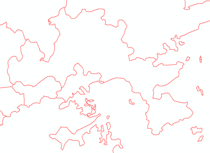
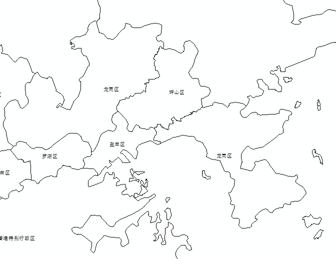
During the production process, I also encountered situations where MCA had administrative codes but the National Fundamental Geographic Information data had no corresponding vectors, for example Pingshan District (坪山区) in Shenzhen. When such issues arise, I first refer to the Tianditu administrative-division data and the MCA vector administrative-division data; if neither is available, I fall back on the AutoNavi (Amap) vector administrative-division data. For example, Pingshan District (坪山区) in Shenzhen has no vector:
 |  |
|---|
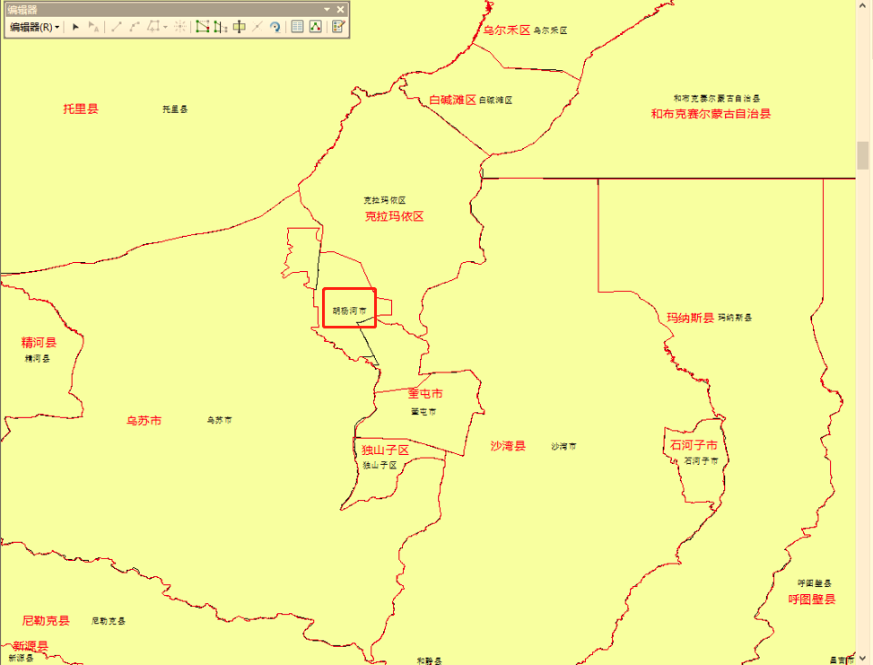
Another example is undelineated areas such as Huyanghe City (胡杨河市) and Kunyu City (昆玉市). For these places, I directly delineated the relevant vectors and added attributes.
# Excess Vector Areas
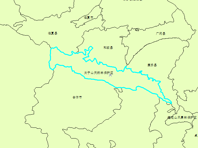
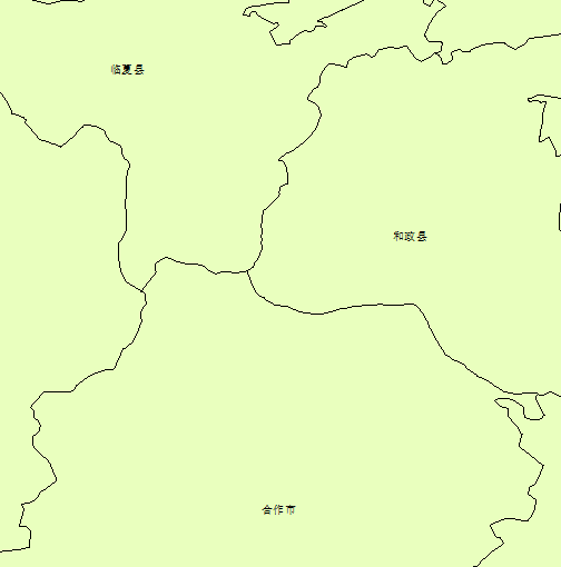
In addition, there are situations where MCA has no code but vectors exist — for example, the Gansu Taizishan Natural Forest Area (甘肃太子山天然林) has an administrative-division vector but administratively falls under several jurisdictions:
 |  |
|---|
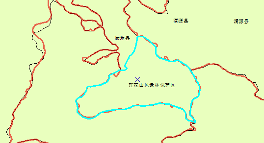
Another example is Lianhuashan Scenic Protection Area (莲花山风景保护区), which has no administrative-division code; referring to the AutoNavi (Amap) administrative-division data, it is merged into Kangle County (康乐县):
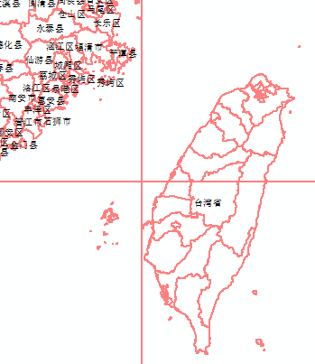
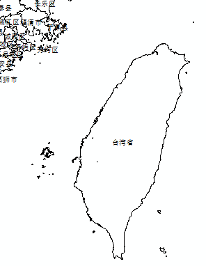
Another rather special case is Taiwan Province (台湾省), which has county-level vectors but only a province-level code in MCA's administrative-division scheme. To ensure that all attributes in this dataset follow MCA, all county-level data of Taiwan Province are merged, and only the province-level vector is retained.
 |  |
|---|
# Attribute-Data Modification
This is also the most time-consuming step; even with attribute data available for the majority, there are still many issues.
# Errors in Codes, Names, etc.
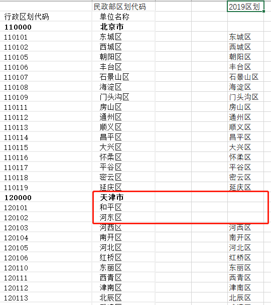
I compared MCA administrative-division codes against more than 300 city-level entries; any divergence points to a specific cause. The field of the city may be mismatched — e.g., Xinhua District (新华区) in Shijiazhuang and Xinhua District (新华区) in Cangzhou (this is the most common case). Or it may have been omitted — e.g., Longgang City (龙港市) under Wenzhou.
# Areas With Empty Prefecture-Level Attribute
In addition, China has several special administrative units, such as province-directly-governed cities (省直辖市) and province-directly-governed counties (省直辖县), which are administratively county-level units but have no prefecture-level unit.
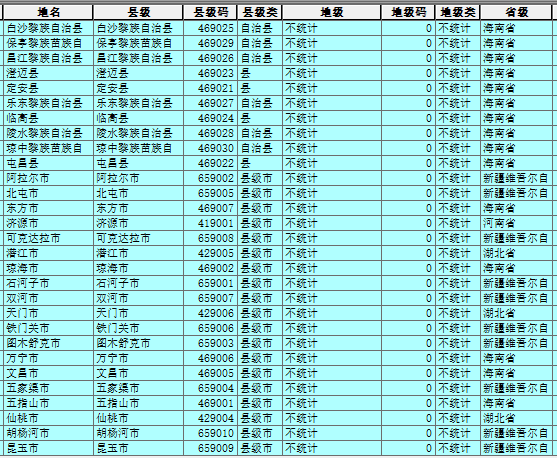
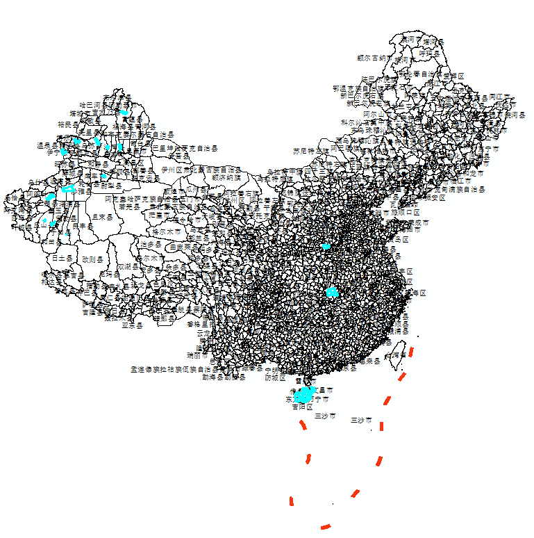
Examples include Qianjiang City (潜江市), Tianmen City (天门市), and Xiantao City (仙桃市) in Hubei Province; Jiyuan City (济源市) in Henan; and Lingao County (临高县) and Dongfang City (东方市) in Hainan. The distribution is shown below; for these areas the prefecture-level attribute is uniformly set to empty.
# Areas With Empty County-Level Attribute
There are also some special areas that are prefecture-level cities but as of the end of 2019 had no county-level administrative units, e.g., Danzhou City (儋州市) in Hainan, Dongguan City (东莞市) in Guangdong. For these areas, the county-level attribute is uniformly set to empty.
| Place name | County-level | County code | County type | Prefecture-level | Prefecture code | Prefecture type | Province |
|---|---|---|---|---|---|---|---|
| Danzhou City (儋州市) | Not counted | 0 | Not counted | Danzhou City (儋州市) | 460400 | Prefecture-level city | Hainan Province (海南省) |
| Dongguan City (东莞市) | Not counted | 0 | Not counted | Dongguan City (东莞市) | 441900 | Prefecture-level city | Guangdong Province (广东省) |
| Jiayuguan City (嘉峪关市) | Not counted | 0 | Not counted | Jiayuguan City (嘉峪关市) | 620200 | Prefecture-level city | Gansu Province (甘肃省) |
| Sansha City (三沙市) | Not counted | 0 | Not counted | Sansha City (三沙市) | 460300 | Prefecture-level city | Hainan Province (海南省) |
| Zhongshan City (中山市) | Not counted | 0 | Not counted | Zhongshan City (中山市) | 442000 | Prefecture-level city | Guangdong Province (广东省) |
| Directly administered by Haixi Mongol and Tibetan Autonomous Prefecture | Not counted | 0 | Not counted | Haixi Mongol and Tibetan Autonomous Prefecture (海西蒙古族藏族自治州) | 632800 | Autonomous Prefecture | Qinghai Province (青海省) |
# Areas With Empty Province-Level Attribute
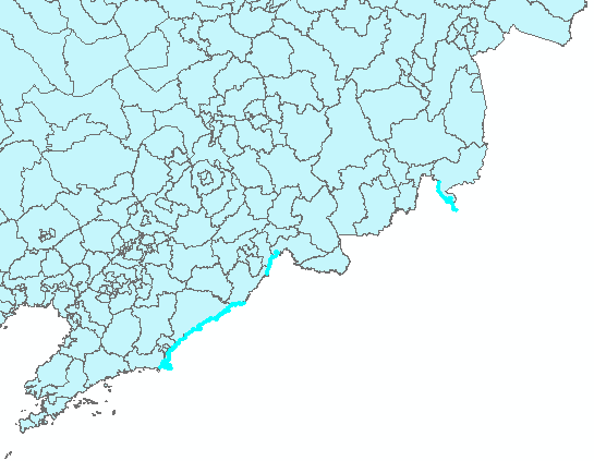
This area is called the China–North Korea shared territory. The National Fundamental Geographic Information data contains a vector for it, but MCA has no relevant administrative-division code, and this cannot be modified. Therefore, all related attributes of this area are left empty, and only the vector is retained.
# Quantity Check
# Check Premises
Before the check, I will first provide a brief overview of China's overall administrative-division levels.
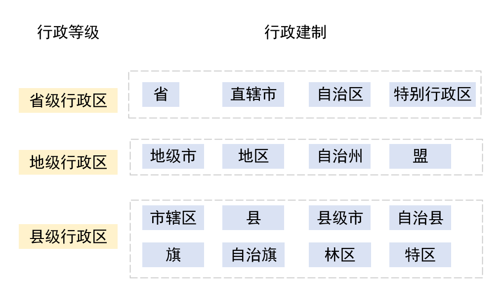
Forestry Area (林区) is one of China's administrative-division types, with an administrative status equivalent to that of district, county-level city, county, autonomous county, banner, autonomous banner, and special district — all are county-level administrative divisions. Currently, there is only one: Shennongjia Forestry Area (神农架林区), directly governed by Hubei Province.
Special District (特区), as used here, refers to Liuzhi Special District (六枝特区), which is a district under the jurisdiction of Liupanshui City in western Guizhou. Currently, there is only one.
Therefore:
Province-level administrative units include: province (省), municipality (直辖市), autonomous region (自治区), special administrative region (特别行政区)
Prefecture-level administrative units include: prefecture-level city (地级市), autonomous prefecture (自治州), prefecture (地区), league (盟)
County-level administrative units include: district (区), county-level city (县级市), county (县), autonomous county (自治县), banner (旗), autonomous banner (自治旗), directly-governed county (直辖县), province-directly-governed city (省直辖市), forestry area (林区), special district (特区).
In addition, there are province-directly-governed counties (省直辖县) and province-directly-governed cities (省直辖市). In the MCA's administrative-division hierarchy, these are not administered by any prefecture-level administrative division. They are county-level administrative divisions, not managed or administered by an intermediate prefecture-level division, but directly governed by a province-level administrative division. They are independently established outside the prefecture-level layer and are directly led and managed by the province or autonomous region in which they are located. Therefore, province-directly-governed counties and province-directly-governed cities have no prefecture-level administrative division and are themselves county-level administrative divisions.
Based on this, the relevant 2019 MCA administrative-division statistics are as follows:
| Total | Administrative-division units | Total | Administrative-division units | Total | Administrative-division units |
|---|---|---|---|---|---|
| 34 | 4 municipalities 23 provinces 5 autonomous regions 2 special administrative regions | 333 | 293 prefecture-level cities 7 prefectures 30 autonomous prefectures 3 leagues | 2846 | 965 districts 387 county-level cities 1323 counties 117 autonomous counties 49 banners 3 autonomous banners 1 special district 1 forestry area |
# County-Level Quantity Check
County-level quantity check is performed for each province; the table is as follows:
| Region | County count | Region | County count |
|---|---|---|---|
| Beijing (北京市) | 16 districts | Hunan Province (湖南省) | 36 districts 18 county-level cities 61 counties 7 autonomous counties |
| Tianjin (天津市) | 16 districts | Guangdong Province (广东省) | 65 districts 20 county-level cities 34 counties 3 autonomous counties |
| Hebei Province (河北省) | 47 districts 21 county-level cities 94 counties 6 autonomous counties | Guangxi Zhuang Autonomous Region (广西壮族自治区) | 41 districts 9 county-level cities 49 counties 12 autonomous counties |
| Shanxi Province (山西省) | 26 districts 11 county-level cities 80 counties | Hainan Province (海南省) | 8 districts 5 county-level cities 4 counties 6 autonomous counties |
| Inner Mongolia Autonomous Region (内蒙古自治区) | 23 districts 11 county-level cities 17 counties 49 banners 3 autonomous banners | Chongqing (重庆市) | 26 districts 8 counties 4 autonomous counties |
| Liaoning Province (辽宁省) | 59 districts 16 county-level cities 17 counties 8 autonomous counties | Sichuan Province (四川省) | 54 districts 18 county-level cities 107 counties 4 autonomous counties |
| Jilin Province (吉林省) | 21 districts 20 county-level cities 16 counties 3 autonomous counties | Guizhou Province (贵州省) | 15 districts 9 county-level cities 52 counties 11 autonomous counties 1 special district |
| Heilongjiang Province (黑龙江省) | 54 districts 21 county-level cities 45 counties 1 autonomous county | Yunnan Province (云南省) | 17 districts 17 county-level cities 66 counties 29 autonomous counties |
| Shanghai (上海市) | 16 districts | Tibet Autonomous Region (西藏自治区) | 8 districts 66 counties |
| Jiangsu Province (江苏省) | 55 districts 22 county-level cities 19 counties | Shaanxi Province (陕西省) | 30 districts 6 county-level cities 71 counties |
| Zhejiang Province (浙江省) | 37 districts 20 county-level cities 32 counties 1 autonomous county | Gansu Province (甘肃省) | 17 districts 5 county-level cities 57 counties 7 autonomous counties |
| Anhui Province (安徽省) | 44 districts 9 county-level cities 52 counties | Qinghai Province (青海省) | 7 districts 4 county-level cities 26 counties 7 autonomous counties |
| Fujian Province (福建省) | 29 districts 12 county-level cities 44 counties | Ningxia Hui Autonomous Region (宁夏回族自治区) | 9 districts 2 county-level cities 11 counties |
| Jiangxi Province (江西省) | 27 districts 11 county-level cities 62 counties | Xinjiang Uyghur Autonomous Region (新疆维吾尔自治区) | 13 districts 26 county-level cities 61 counties 6 autonomous counties |
| Shandong Province (山东省) | 57 districts 27 county-level cities 53 counties | Hong Kong SAR (香港特别行政区) | |
| Henan Province (河南省) | 53 districts 22 county-level cities 83 counties | Macao SAR (澳门特别行政区) | |
| Hubei Province (湖北省) | 39 districts 25 county-level cities 36 counties 2 autonomous counties 1 forestry area | Taiwan Province (台湾省) |
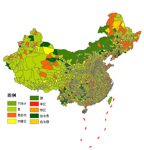
During the check, incorrect county-level type attributes were corrected, and the resulting distribution of county-level types in China is shown below:
# Prefecture-Level Quantity Check
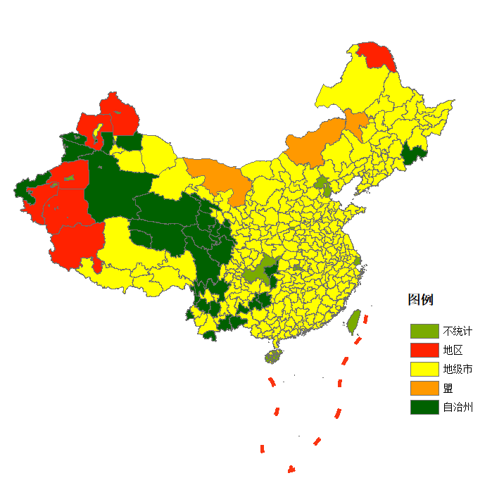
This step is performed after the data merge, checking the prefecture-level types for each province. The main points to note are several prefecture-level cities without county-level administrative units, and municipalities without prefecture-level administrative units. The resulting distribution of prefecture-level types in China is shown below:
# Data Merge
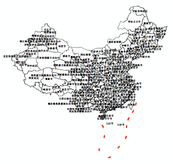
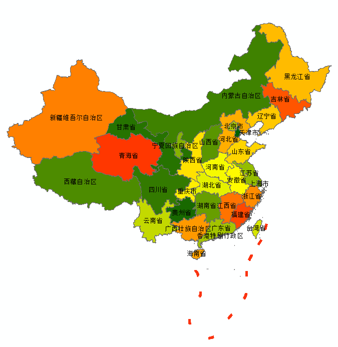
After verifying the vector and attribute information, the Dissolve tool is used to merge the data at the prefecture-level and province-level.
China's prefecture-level data is shown in the figure below:
China's province-level data is shown in the figure below:
# Adding English Attributes
Referring to the GADM attribute information, English attributes are added to the vector data. The mapping between the original and English attribute names is as follows:
| Chinese | English attribute name |
|---|---|
| Place name | NAME |
| County-level | NAME_3 |
| County code | GID_3 |
| County type | TYPE_3 |
| Prefecture-level | NAME_2 |
| Prefecture code | GID_2 |
| Prefecture type | TYPE_2 |
| Province-level | NAME_1 |
| Province code | GID_1 |
| Province type | TYPE_1 |
| Pinyin annotation of place name | VAR_NAME |
| Pinyin annotation of county-level | VAR_NAME3 |
| Pinyin annotation of prefecture-level | VAR_NAME2 |
| Pinyin annotation of province-level | VAR_NAME1 |
The English mapping for the province-, city-, and county-level type names is as follows:
| Chinese name | English name | Chinese name | English name |
|---|---|---|---|
| County | County | Prefecture-level city | Prefecture-level city |
| County-level city | County-level city | Autonomous prefecture | Autonomous Prefecture |
| Autonomous county | Autonomous County | Prefecture (地区) | Prefecture |
| District (市辖区) | District | League | League |
| Banner | Banner | Municipality | Municipality |
| Autonomous banner | Autonomous Banner | Province | Province |
| Forestry area | Forestry Area | Autonomous region | Autonomous Region |
| Special district (county level) | Special District | Special district (省/直辖市级别) | Special District |
| Not counted | NULL |
In addition, considering that Hanyu Pinyin is a romanization system that represents the pronunciation of Mandarin, which was later adopted as the writing convention for external promotion — this is also why we see most provinces and cities in English rendered in Pinyin. Some regions use non-Pinyin spellings, namely Postal Romanization. For example, in Guangdong, Guangxi, and Fujian, some places already have conventional Latinized spellings, such as Amoy (Xiamen), Canton (Guangzhou), Foochow (Fuzhou).
However, considering that China has consistently used Pinyin to represent place names, and the United Nations officially adopted Hanyu Pinyin for spelling mainland China place names from 1977 onward, this dataset fully adopts the Pinyin system for place names. For regions with a single-character name, such as Heng County (横县) in Guangxi and Lin County (临县) in Shanxi, the county name is retained and then re-applied. For places named after ethnic groups, the English name of the ethnic group is retained.
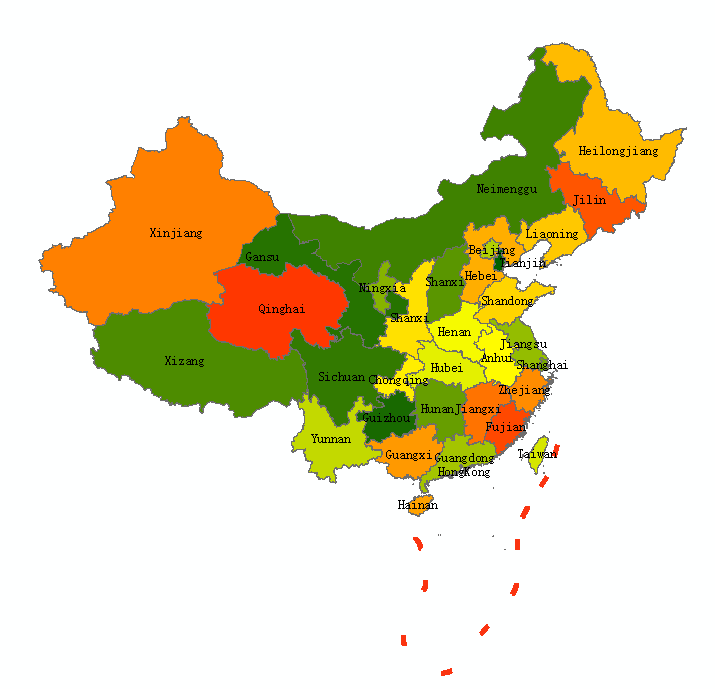
At this point, we have obtained the complete province/city/county administrative-division vector data with English attributes.
# Data Access
China's nationwide province/city/county administrative-division vector data, early 2020 Baidu Cloud Link: https://pan.baidu.com/s/1rXzkX8pNBhmxJQ_QZP6sQw?pwd=4444 (opens new window) Extraction code: 4444 Alibaba Cloud Link: https://www.aliyundrive.com/s/RFUJzXQ76vA (opens new window) Extraction code: 8ve5
# Final Notes
Why did I choose to do this? It is because while building my own website (landcover100.com), I frequently encounter problems with administrative-division data. Which administrative-division dataset to use has been a constant source of trouble. Tianditu data? Incomplete. ResDC data? Too old. AutoNavi (Amap) data? Insufficient attributes. So at first I planned to use the Shudu Chengshi (数读城事) version of the administrative-division data, because it is complete and high quality. But that dataset has two issues: first, the underlying base data is not uniform — it uses the National Fundamental Geographic Information data at one point and then switches to AutoNavi (Amap) data; second, the dataset is not openly accessible. Yet this is the highest-quality Chinese administrative-division dataset currently available on the market. In producing this dataset, I stood on the shoulders of the "Shudu Chengshi (数读城事)" giant, and I would like to express my respect once more.
Therefore, I decided to make my own usable dataset. I started with two ideas: one was to use MCA's administrative-division data, which has very high boundary accuracy and no offset — but the issue is that MCA has not released this data, making it hard to write a proper data-source statement (am I supposed to say I obtained it by web scraping? haha). The other was the approach taken in this article: based on the county-level vector data released by the National Geomatics Center of China, which, while not highly precise, is authoritative and allows a clear data-source statement.
Therefore, I plan to use this data, together with the historical administrative-division changes published by MCA, to build a long time-series administrative-division dataset. The early-2020 administrative-division dataset (as of 31 December 2019) serves as the foundation, and I will expand on it to build administrative-division data for 2015–2022 within six months. Please stay tuned.
# References
National Geomatics Center of China. https://www.ngcc.cn/ngcc/html/1/index.html
Chinese Academy of Sciences Resources and Environment Science and Data Center. https://www.resdc.cn/
Public account: Shudu Chengshi (数读城事). 2021 Annual Administrative-Division Adjustment Data Update and Sharing (Province/City/County, as of 31 December 2021). https://mp.weixin.qq.com/s/KtYlB2jA67jvdcE9fKyEPQ
Public account: Diandian GIS (点点GIS). Latest National Administrative-Division Data, 5 July 2022. https://mp.weixin.qq.com/s/KJnHD45QdqXdmHVuHZA9d
Codes of county-level-and-above administrative divisions of the People's Republic of China, December 2019. https://www.mca.gov.cn/article/sj/xzqh/1980/2019/202002281436.html
China National Place-Name Information Database. https://dmfw.mca.gov.cn/index.html
gadm. https://gadm.org/
datav. http://datav.aliyun.com/portal/school/atlas/area_selector